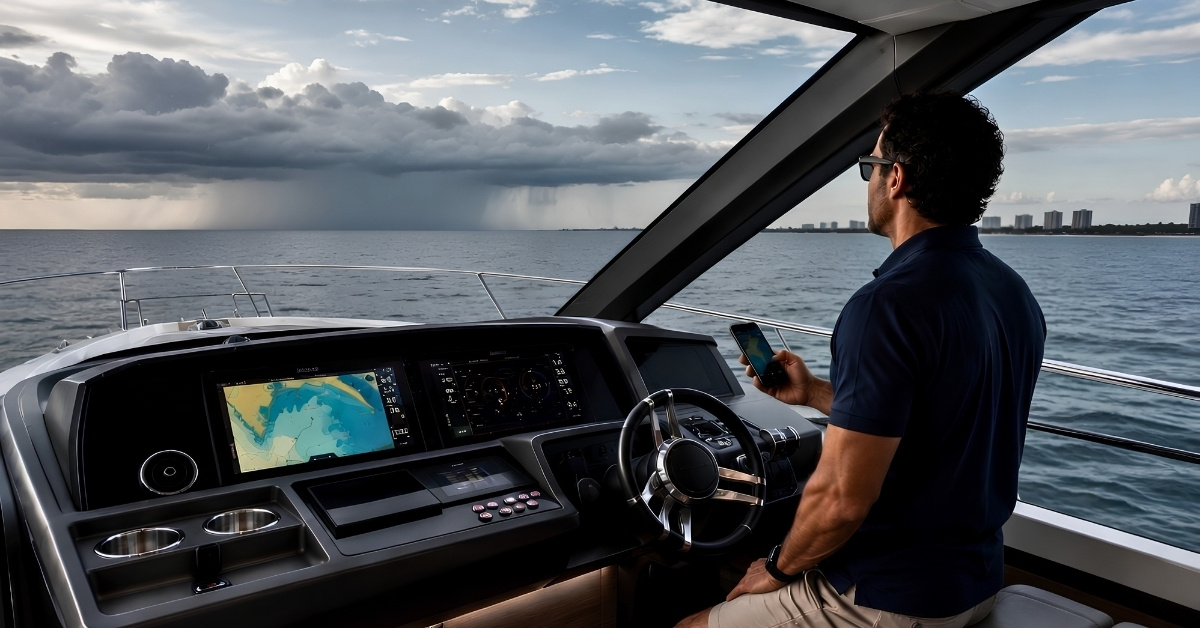
Summer boating gets tricky when the weather turns. One minute the water looks manageable. Thirty minutes later, the wind shifts, the sky darkens, and every boat in the area seems to be headed for the same marina entrance. That is why smart trip planning starts with the right weather tools long before the first line is cast off.
No single app does everything perfectly. The best setup usually includes one app you trust for visual forecasting, one for marine-specific detail, and one official source for warnings and forecast confirmation. If you build that habit now, you make better calls earlier. That protects your crew, your schedule, and your boat.
Start With The App That Helps You See The Whole Picture
Windy is one of the best visual tools for getting a quick read on developing conditions. It gives boaters an easy way to track wind movement, rain bands, pressure, and changing systems in a format that makes sense at a glance. If you are trying to decide whether to leave early, stay put, or reroute, Windy is often the fastest place to start.
This is the app for pattern recognition. You open it when you want to understand what is building, where it is moving, and how fast the day may tighten up.
Use PredictWind When The Trip Itself Needs Planning
PredictWind is especially useful for longer runs, exposed routes, and offshore-minded boaters who need more than a quick local snapshot. Routing tools, wind data, wave information, and current-aware planning make it a strong choice for captains who need to think ahead instead of simply reacting.
For coastal cruising, crossings, or any day where the return trip matters as much as the departure, PredictWind earns its spot. It helps answer the question serious boaters ask early. What does this route look like three hours from now?
Buoyweather Is Strong When Location Matters More Than Broad Coverage
Buoyweather is useful for boaters who want forecast detail tied to a specific point on the water. Wind, swell, and tide forecasts for saved locations make it practical for people who return to the same inlet, bay, reef, or anchorage throughout the season.
That makes it a smart tool for anglers, weekend cruisers, and owners who run familiar territory but still need to know how one area may behave differently than the water ten miles away.
Windfinder Is A Practical Pick For Day Boaters And Local Pattern Watchers
Windfinder is popular for a reason. It is simple to use, clear on wind and wave trends, and good for quick checks before leaving the dock. If your boating life revolves around shorter runs, local knowledge, and timing your day around afternoon breeze, it can be a very effective tool.
Some apps are built for deep analysis. Windfinder is often about clean decisions. Go now. Wait an hour. Pick the protected side. Skip the open stretch.
NOAA Is Still The Authority
This part matters. When there is any doubt, check the official forecast.
The NOAA marine forecast remains the backbone for U.S. boaters who want the actual warnings, forecast zones, and marine point forecasts behind the other apps. Apps are useful. Visual models are useful. Official forecast and warning information still needs to be part of the routine.
A clean system works well here. Use the visual apps to spot trends. Use NOAA to confirm what matters.
The Best App Stack Depends On How You Boat
For short local trips, a combination like Windy + NOAA is usually enough.
For coastal cruising, Windy + PredictWind + NOAA gives you strong visual forecasting, route planning, and official confirmation.
For repeat trips to the same area, Buoyweather + NOAA can be a very efficient pairing.
For casual day boating with a close eye on wind, Windfinder + NOAA is a solid setup.
There is no prize for using five apps badly. Two or three used consistently is better than downloading everything and trusting none of it.
Weather Awareness Should Change Your Gear Decisions Too
Experienced boaters treat gear readiness and weather awareness as the same preparation, not two separate checklists.
If a summer forecast turns unstable, you may end up adjusting the route, taking a side tie you did not expect, anchoring in a more crowded area, or coming into a marina with a lot more traffic than planned. That is when protection gear starts doing real work.
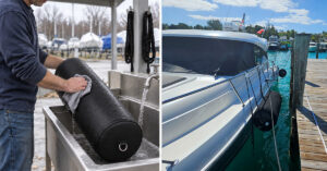
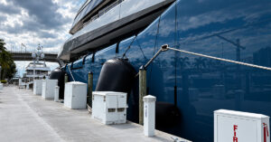
Keep inflatable boat fenders ready to deploy quickly when conditions shift and dock space gets tight. Make sure your dock lines are sized correctly and easy to reach. If you spend time rafted up or tied off for long stretches, Fenda-Sox fender covers protect the hull and keep the fender setup looking clean at the dock. For hull maintenance and detailing while the boat is in the water, an inflatable work platform is a practical addition to the onboard kit.
Storm planning is not just about avoiding the worst case. It is about being ready when the day changes shape.
The Best Boaters Do This Before They Need To
Every weather app on your phone is only as useful as the habit behind it. Check early. Cross-check often. Learn what each tool does well. Pay attention before the first dark cloud reaches the horizon.
That is how experienced boaters stay ahead of the day. They do not wait for weather to force the decision.
Frequently Asked Questions (FAQs)
Creating an effective forecasting system requires using two or three distinct tools consistently. A reliable strategy combines one application for visual forecasting, a second for specific marine details, and an official source like NOAA to confirm warnings. Downloading too many programs often creates confusion. Captains achieve better results by learning the specific strengths of a few chosen tools and checking them early in the planning process.
Windy provides a clear visual snapshot of building weather conditions. Captains use this tool for pattern recognition to track wind movement, pressure changes, and approaching rain bands. The interface makes complex weather systems easy to read quickly. This layout helps crews make timely decisions about leaving early, altering routes, or remaining at the dock as systems develop.
PredictWind supplies the detailed data required for extended runs and exposed coastal cruising. The application features advanced routing tools, wave information, and current-aware planning capabilities. Captains use this program to anticipate conditions several hours ahead of their departure. This capability helps crews evaluate the entire journey and understand exactly what the route will look like during the return trip.
Windfinder and Buoyweather both serve day boaters exceptionally well. Windfinder offers a simple interface for checking wind and wave trends before timing an afternoon run. Buoyweather provides precise forecast details tied directly to specific coordinates. Users can save familiar inlets and anchorages to monitor localized wind, swell, and tide data. These targeted tools ensure crews understand how their chosen destination will behave compared to surrounding waters.
The official NOAA marine forecast serves as the primary authority for actual warnings and forecast zones in the United States. Modern applications offer excellent visual models and trend analysis. Crews must verify those trends against official government data. Checking NOAA confirms the exact parameters of marine point forecasts and ensures captains have accurate warning information before leaving the dock.